
Walk DuPage County Streets by Address
A sound DuPage County street directory search separates ownership from signs of residence. The Supervisor of Assessments Property Records Search supplies the current parcel owner, situs address, billing name, tax year, and parcel identification number, or PIN. A deed names parties to a recorded instrument. A voter result confirms a match-specific election record. A printed directory shows what its publisher listed in one year. None proves that every person at an address has been found.
Work from the most exact address available. Keep street direction and suffix, because North Main Street and Main Road are not safe substitutes. Record the tax year and source date beside every result. The sequence below turns one address into a street-by-street trail without treating a list of owners as a list of occupants.
- Enter the number and street in the assessor search. Open the PIN and save the situs, billing name, owner, and tax year as separate fields.
- Search that PIN or address in the county parcel viewer. Click nearby parcels to follow the named street and confirm its city, subdivision, and district setting.
- Use the Recorder index with the PIN, current owner, or street address. Note each document number, date, grantor, grantee, and legal description.
- Run the county voter lookup only for a specific, lawful name or address match. Treat precinct and district details as election facts, not a household roster.
- For an older occupant, consult Wheaton Public Library's Haines criss-cross books and phone runs for the right publication year.
When the task shifts from a whole road to one named person, use the DuPage County resident lookup to verify that identity across separate sources.
DuPage County Street Search Fields
The assessor landing page offers PIN, address, billing-name, and map paths. Its live service was under maintenance during the research check, so the direct address screen and alternate routes matter. The billing or mailing address can be useful, but it is not the parcel's physical location and does not prove where an owner lives.
| Search route | Input | Best use | Limit |
|---|---|---|---|
| Address | Street number and street name | Turn a situs into a PIN | Spelling and direction must match |
| PIN | Parcel identification number | Open one parcel card | Preserve leading zeroes |
| Billing name | Owner or billing name | Find tax-account clues | Not proof of occupancy |
| Map | Visual parcel area | Browse the same block | Confirm each selected PIN |
The assessor warns that data reflect the last certified date, may change, and cannot be mined at scale. Search interactively. If the public screen is down, call the Supervisor of Assessments at 630-407-6500 or make a focused request through its county FOIA custodian.
Read DuPage County Address Keys
Four address keys often appear in a DuPage County street directory project. A situs is the physical parcel address. The billing address is where a tax notice goes. The legal description identifies land through lot, block, subdivision, or boundary terms. The PIN is the county parcel key. A mismatch among them is a reason to reconcile records, not proof that one record is false.
- Parcel
- A mapped piece of land identified by a county PIN.
- Situs address
- The physical location assigned to the parcel, which may differ from its mailing address.
- Plat
- A recorded map that can show lots, subdivisions, dedications, vacations, and boundary changes.
- Criss-cross directory
- A printed reverse directory arranged by street and house number rather than by surname.
A parcel split or annexation can break an address-only trail. Keep the legal description and search Recorder document groups for subdivision, resubdivision, annexation, dedication, and vacation plats.
Browse DuPage County Streets in GIS
The DuPage County Parcel Viewer accepts a PIN, address, partial advanced address, subdivision, or intersection. A map selection can expand beyond a single hit. The viewer also has layer controls, print and export tools, and a buffer function. County help sets a 1,000-parcel selection cap, so it is built for focused map work, not a countywide resident export.
The property map search is visible at its official source.
The map screen is the bridge from one known parcel to the next parcel along a road, after which each PIN should be checked on its own dated card.
Use the Results pane and map popup to record parcel keys. Layers can add roads, subdivisions, districts, and imagery, but a visible boundary is not a resident list. Export only the small set needed for the lawful research task.
DuPage County Records Indexed by Street
Each address-keyed source answers a different question. The assessor is strongest for the current tax parcel, GIS for location, the Recorder for recorded instruments, and local building offices for work tied to an address. The county voter tool is match-specific. Historical reverse volumes belong to a fixed publication year.
| Address record | Custodian | Evidence found | How to reach it |
|---|---|---|---|
| Parcel card | Supervisor of Assessments | Owner, situs, billing name, PIN, tax year, sales | Address, PIN, name, or map search |
| Parcel geometry | DuPage GIS/IT | Adjacent parcels, roads, subdivision, districts, imagery | Viewer, export, or focused FOIA request |
| Recorded documents | Recorder of Deeds | Grantor, grantee, deed, lien, plat, date, legal description | Web index, office books, terminal, research line |
| Voter match | Election Division | Status, precinct, polling place, ballot, districts | Specific name or address lookup |
| Permit and code file | Municipal or county building office | Applicant, parcel work, plans, inspection or case trail | Portal, clerk, department, or FOIA |
| Reverse directory | Wheaton Public Library | Published name, address, and sometimes phone | Local-history room and appointment |
The chain works because the PIN connects the parcel card, map, and many recorded documents. A street label alone is weaker, especially if a road crossed a town line or changed through a plat.
A street directory result is strongest when the parcel, instrument, and publication year agree, while each source still keeps its own meaning.
Deeds Along a DuPage County Street
The DuPage County Recorder Online Document Search has name, bank or trust, subdivision or business, street, city, four-part PIN, document number, document group, and date-range fields. Its public name and image index begins in 1961. PIN searching begins in 1985, address searching in 1995, while office property records reach 1839 and plats reach into the 1800s.
Start with the current grantee shown by the deed or sales card. Search that person or entity as a prior grantee, then follow the former grantor backward. Include deeds, quit claims, PTAX records, plats, easements, mortgages, and releases when they explain the chain. Older books, research help, and certified copies remain available at the Recorder, 421 N. County Farm Road in Wheaton, through 630-407-5401.
The official parcel sales card for Anthony Street is available at its county source.
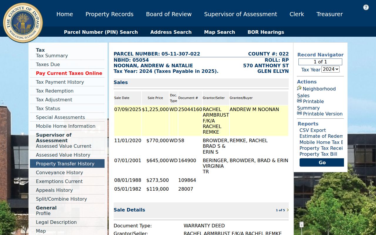
The captured card shows how sale date, deed type, document number, grantor, grantee, and Recorder link fit together without claiming that any named owner occupies the site today.
DuPage County Street Permit Trails
Permit custody depends on the address. Wheaton Building holds applications, plans, plats, inspections, contractor registrations, and code files. Its public permit status page requires a user ID and password. Naperville offers Civic Access plus monthly issued-permit PDFs, while unincorporated work may route to DuPage Building and Zoning.
The Wheaton status gateway appears at the official page linked above.
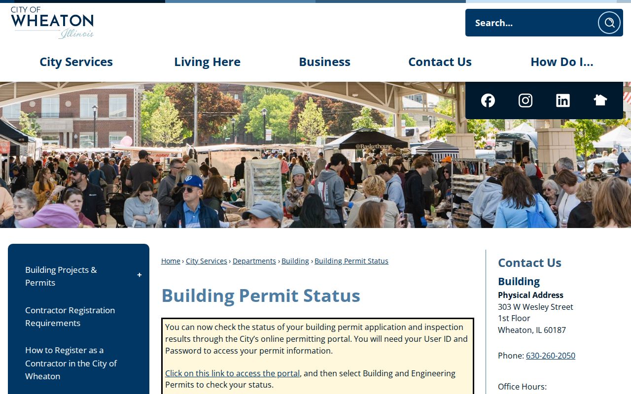
The login screen explains why a portal-only search can stop short. Ask the department for the address and date range, or use municipal FOIA for a historical permit or inspection file.
Wheaton accepts requests online, in person, by mail, email, or fax. Naperville Building Permits can be reached at 630-420-6100 option 2, and Code Enforcement at 630-420-6693. First verify the municipality and county through the parcel.
Reverse a DuPage Street Year
Wheaton Public Library holds West Suburban Haines Criss-Cross volumes for 1988 through 2021 and Near West Suburban Haines volumes for 2004 through 2021. These books arrange entries by address, making them the historical counterpart to a modern street directory. Wheaton phone books cover 1951 through 2016, and suburban telephone microfilm covers 1920 through 1971.
Choose the volume closest to the date of interest, check its geographic scope, photograph the abbreviation key, and then scan both sides of the target number. A published listing is a dated lead. It does not show every member of a household. Full detail about these historical shelves belongs on the DuPage County city directory page.
Wheaton Street Number Clues
The inspected 1915-16 Bumstead directory gives one local numbering clue. Its text says Wheaton's east-west streets were numbered from Main Street, north-south streets from Front or Michigan, with odd numbers north or east and even numbers south or west. This applies to that historical Wheaton source, not to every DuPage municipality.
Old settlement names can also disrupt a modern search. Museum material preserves Cloverdale, Fullersburg, Eola, and York Center. If an old entry uses one, pair the name with its township and search the legal description, subdivision, and plat. No official countywide renumbering ledger was found, so a municipal clerk or GIS request is the best fallback for an old-to-new address crosswalk.
Note: Preserve the old spelling and street form before testing a modern normalized address.
DuPage Streets Cross Record Lines
A postal city is not always the legal municipality or county. Naperville spans DuPage and Will Counties. The city describes its DuPage portion as generally north of 87th Street, so a Naperville address south of that line may lead to a different tax, court, permit, or vital-record custodian. Other ZIP and town edges also cross county lines.
Resolve the PIN, county, municipality, and legal situs before ordering a file. Then note which office created the record. A city permit and county deed may both be valid for the same site, yet they answer different questions and follow different boundaries.
Limits of DuPage Street Records
A DuPage County street directory cannot supply a complete household roster. Parcel records name owners, which may be trusts or entities. A billing address may lie elsewhere. Deeds identify parties to instruments, not all people at the site. Voter access is regulated and match-specific, while utility account details, motor-vehicle addresses, sealed court matters, and sensitive police or health facts are not open address lists.
Illinois's Address Confidentiality Program can give an eligible survivor a substitute address and mail forwarding. It does not erase deeds, old papers, or property records that already exist. A missing or substitute address is a stop point, not an invitation to work around a safety measure.
Lawful use. Use DuPage County address records only for lawful personal research. Never use a street search to stalk, harass, intimidate, or harm anyone.
If an online portal fails, use the custodian chain: office terminal, research phone, municipal clerk, focused records request, library appointment, or museum archive. State the address, PIN, record type, and time span. That produces a narrower and more reliable response than asking for every person on a road.
The final street directory notes should retain the custodian, access date, address form, and PIN so another reader can verify the same trail.